SupplementaryPositionalDescription (lane, carriageway...)
This section describes the "SupplementaryPositionalDescription".
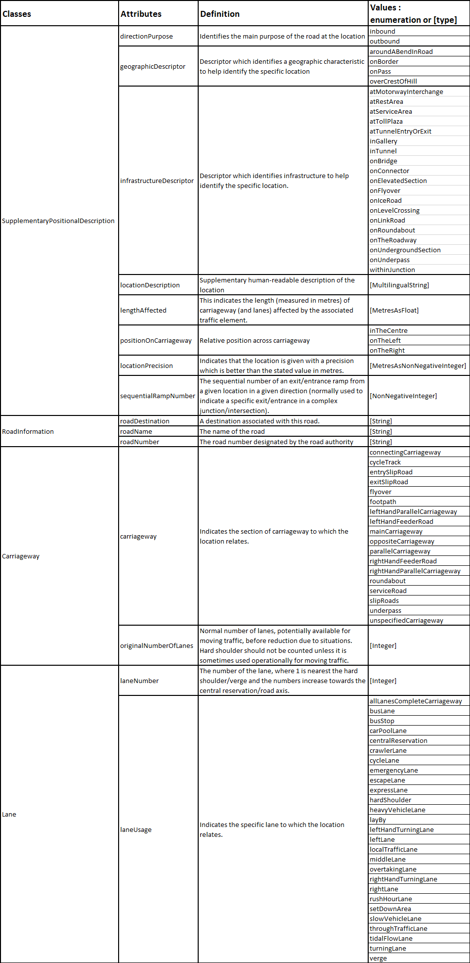
Supplementary positional information may be added to a road network element for describing the road, or transversal position of the element to be located on the road.
Therefore, the following elements may be defined:
- the main direction purpose of the road at the location;
- the geographic descriptor which identifies a geographic characteristic to help identify the specific location;
- the infrastructure descriptor which identifies infrastructure to help identify the specific location;
- the length (measured in metres) of carriageway (and lanes) affected by the associated traffic element;
- the location description which is a supplementary human-readable description of the location;
- the location precision which indicates that the location is given with a precision which is better than the stated value in metres;
- the relative position across carriageway;
- the sequential number of an exit/entrance ramp from a given location in a given direction (normally used to indicate a specific exit/entrance in a complex junction/intersection).
Besides it may be completed by transverse information:
- on the road: name, number, or destination;
- on the exact carriageway(s), with for each the corresponding lane(s) and the affected length;
- on the concerned area (see package “NamedArea”).
The following table gives indications on the contents of the various common attributes used by the classes related to the "SupplementaryPositionalDescription" package.